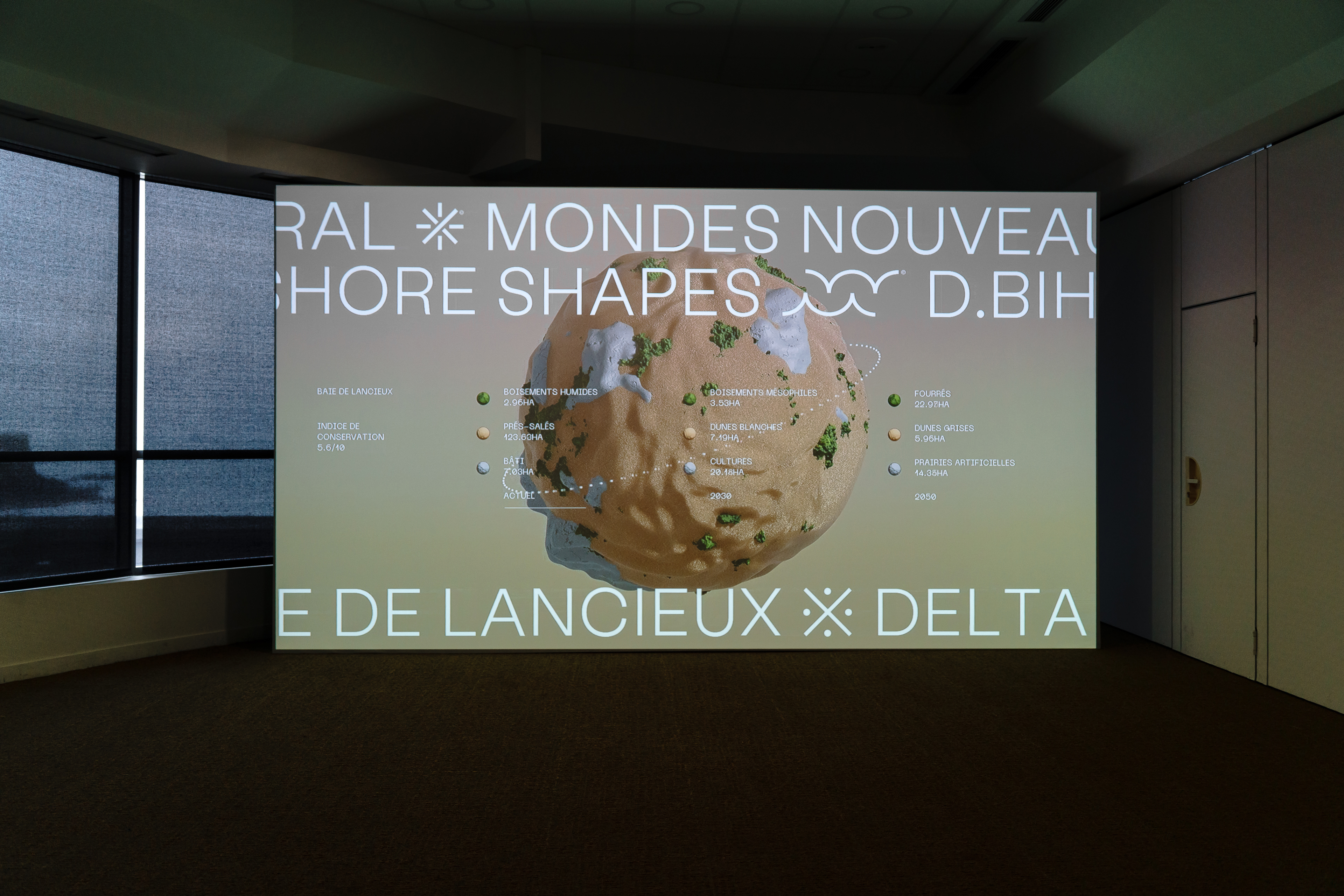
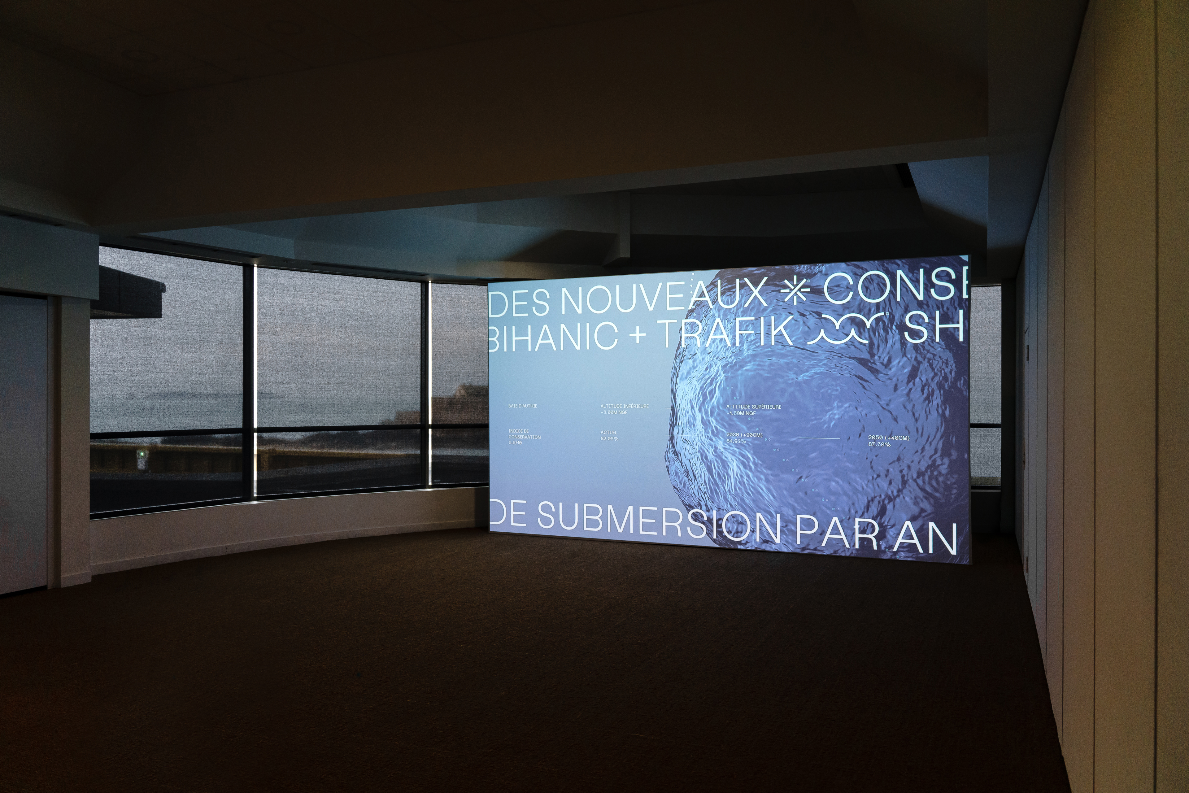
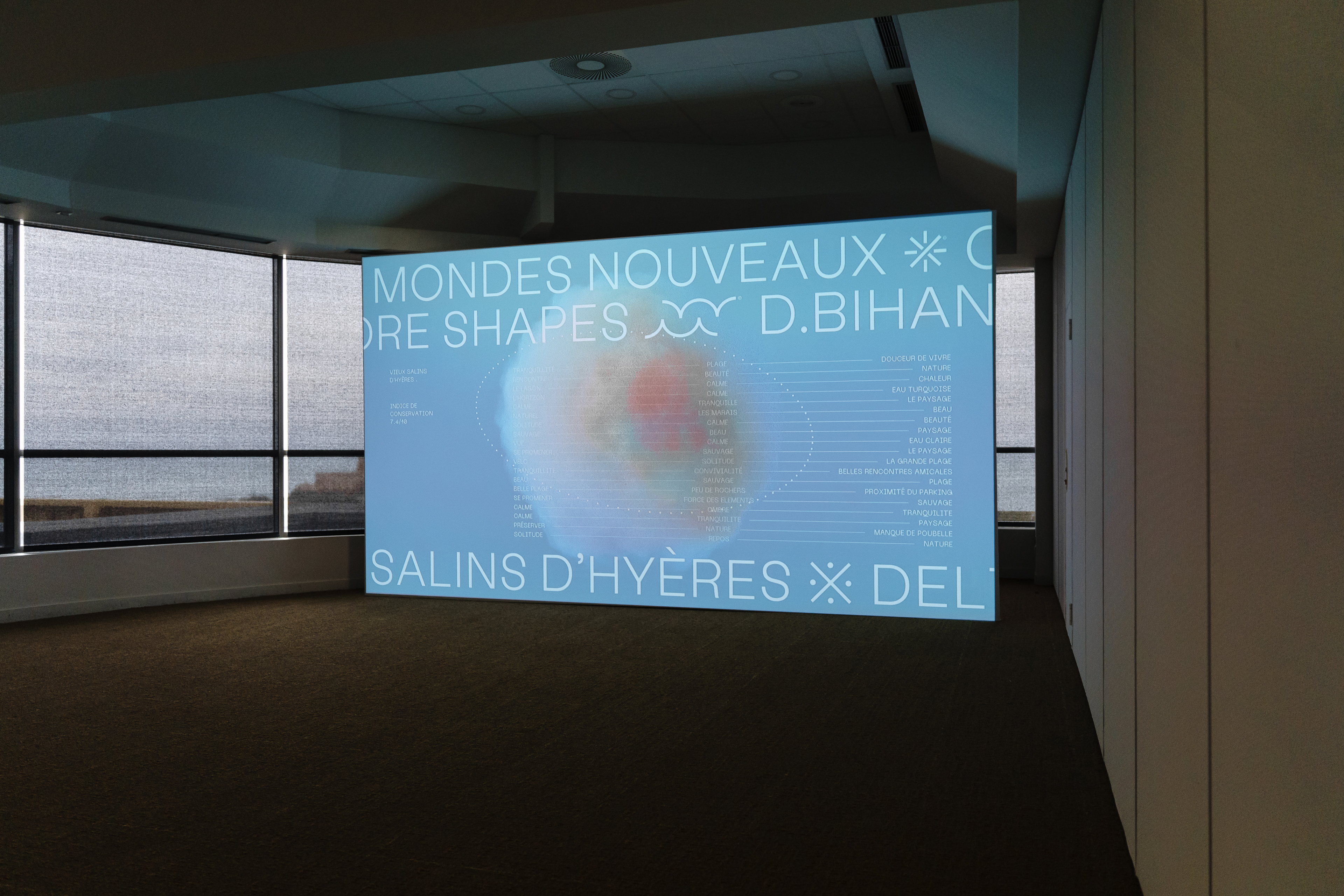
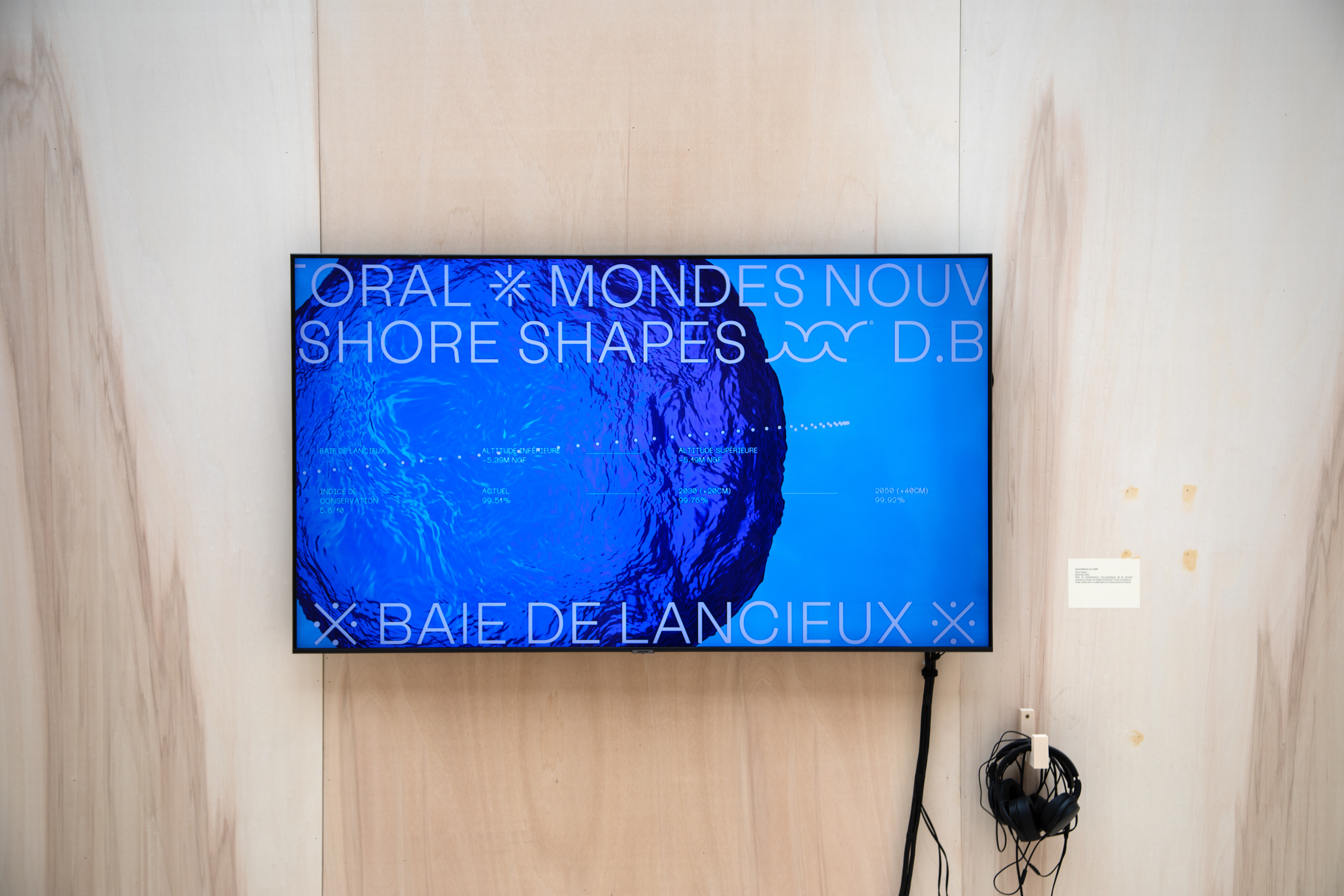
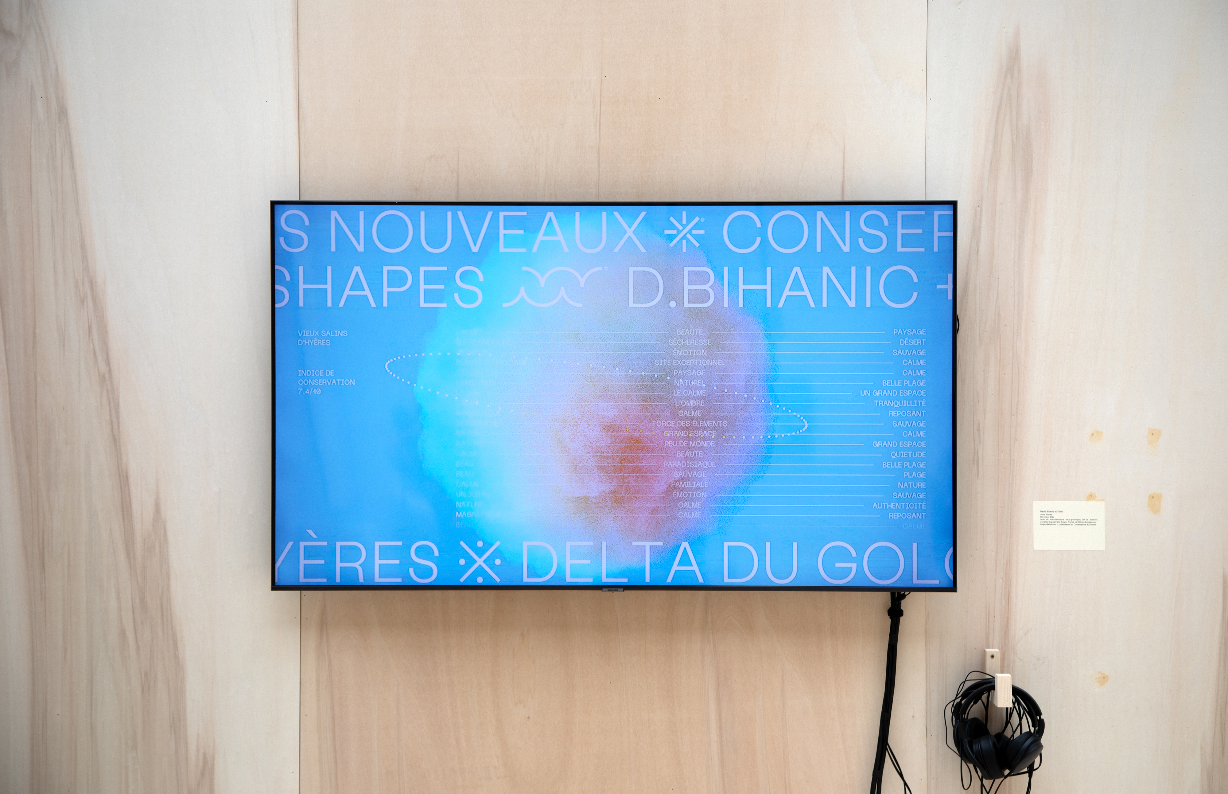
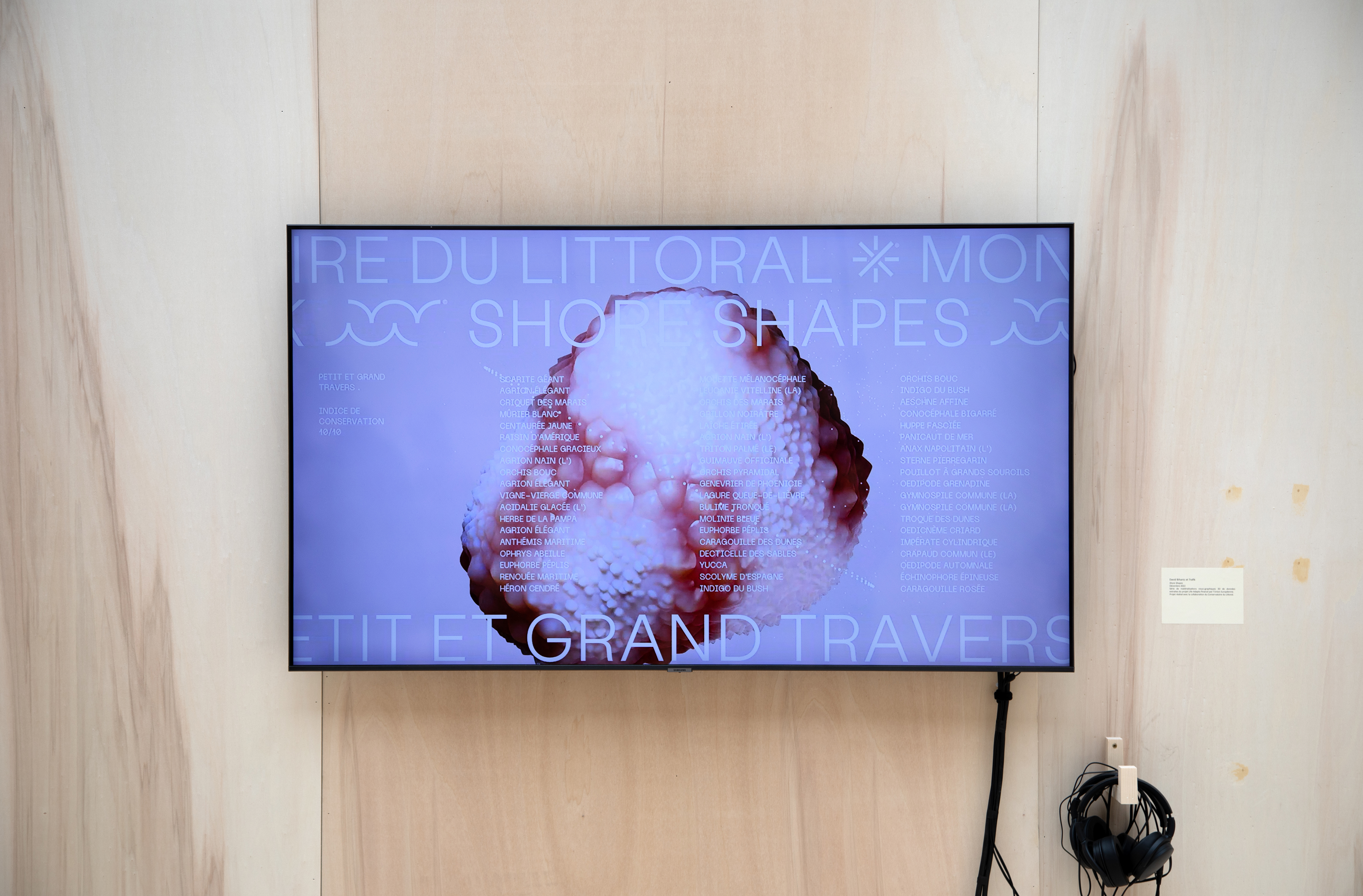
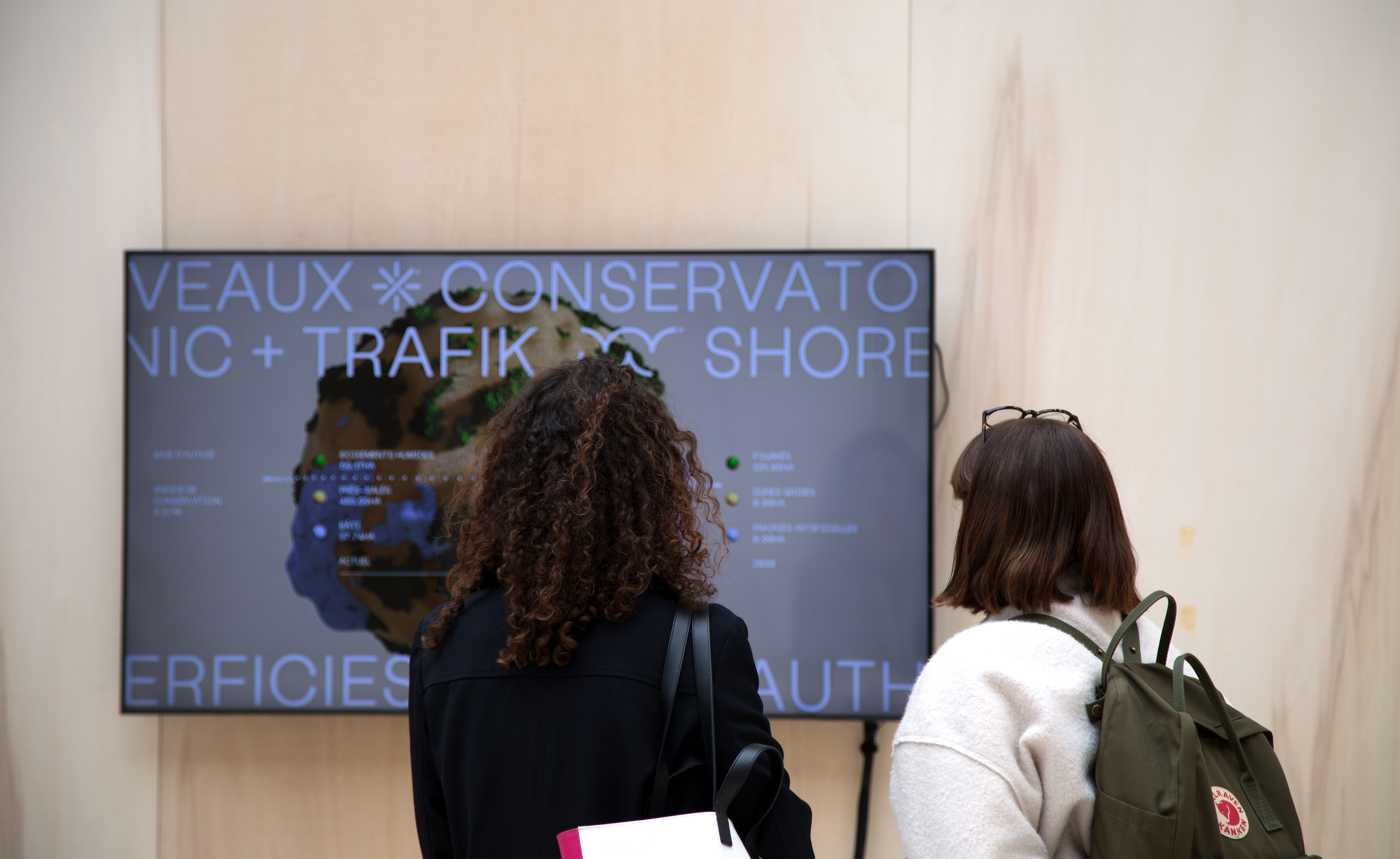
3D data materialization of ten french natural sites: Authie Bay, Orne estuary, Lancieux Bay, Moëze Marsh, Gironde estuary, Leyre Delta, Petit and Grand Travers, Vieux Salins of Hyères, Golo Delta,Rice fields of Mana
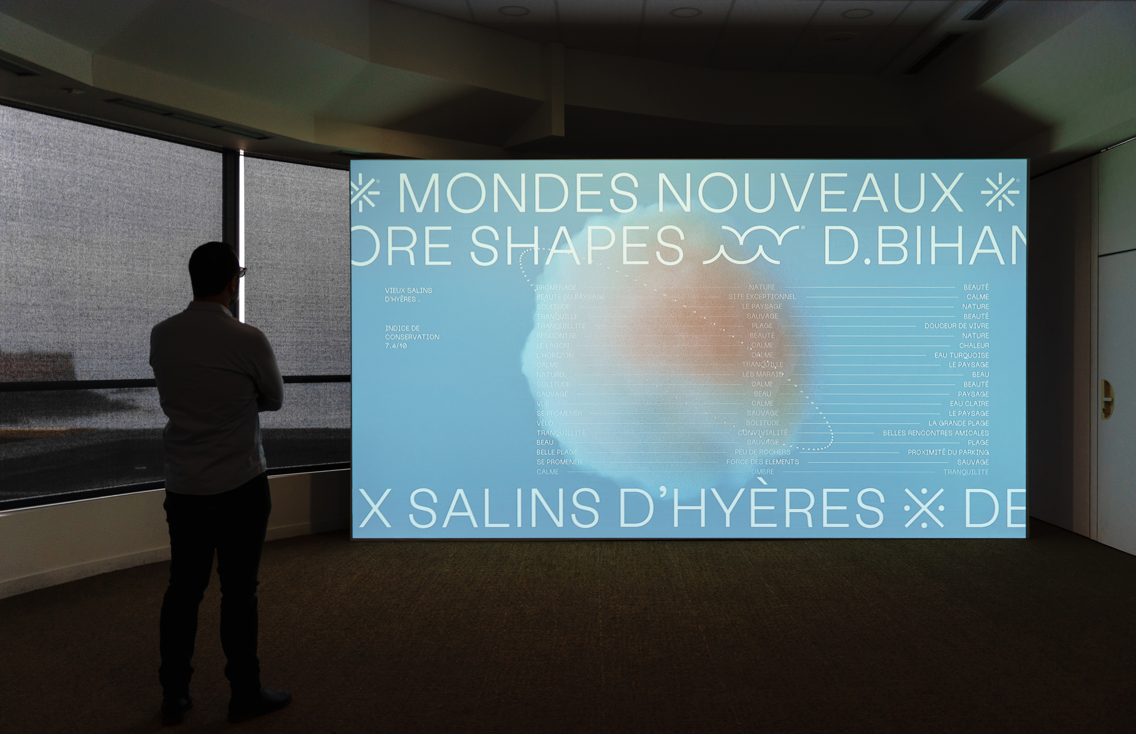
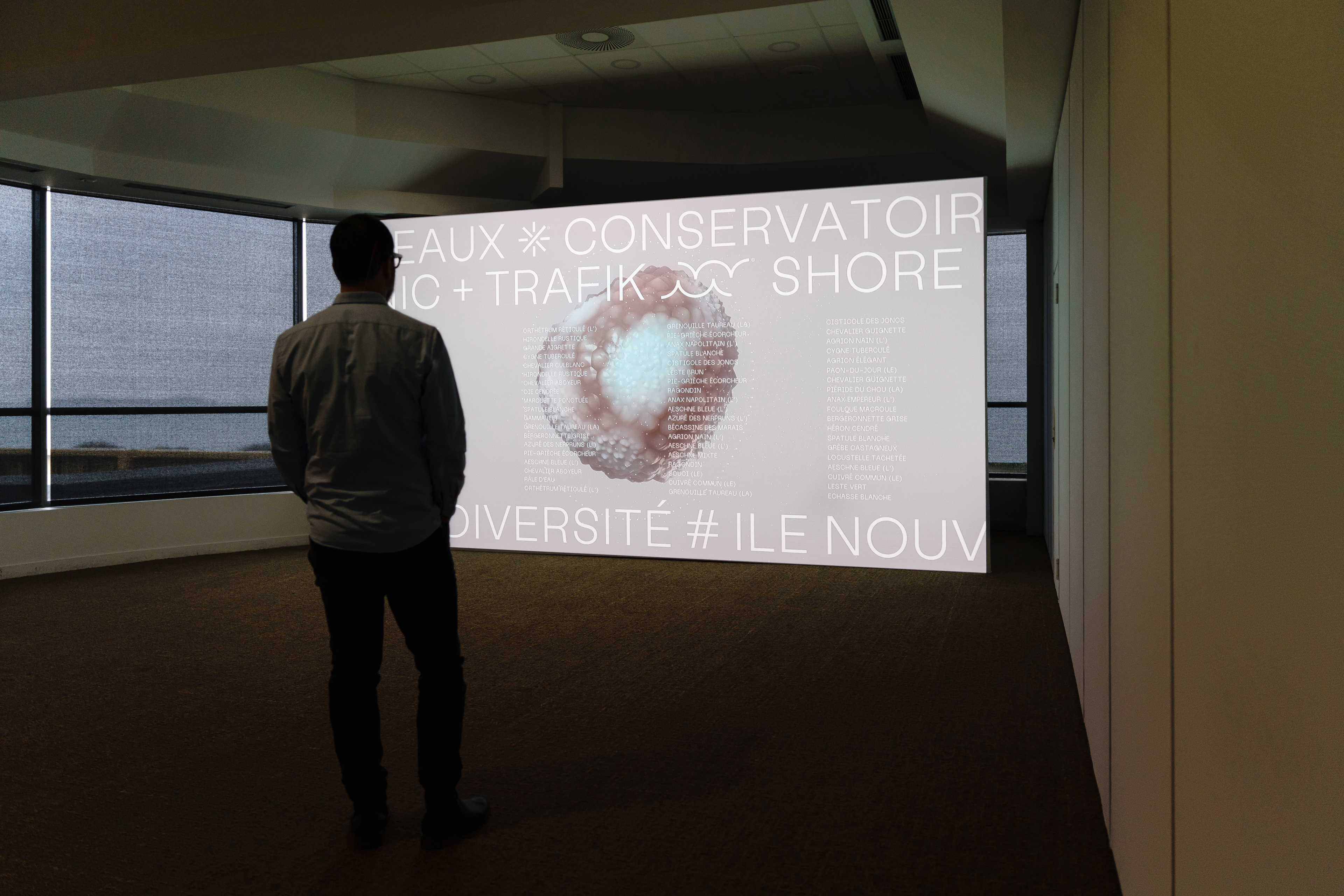
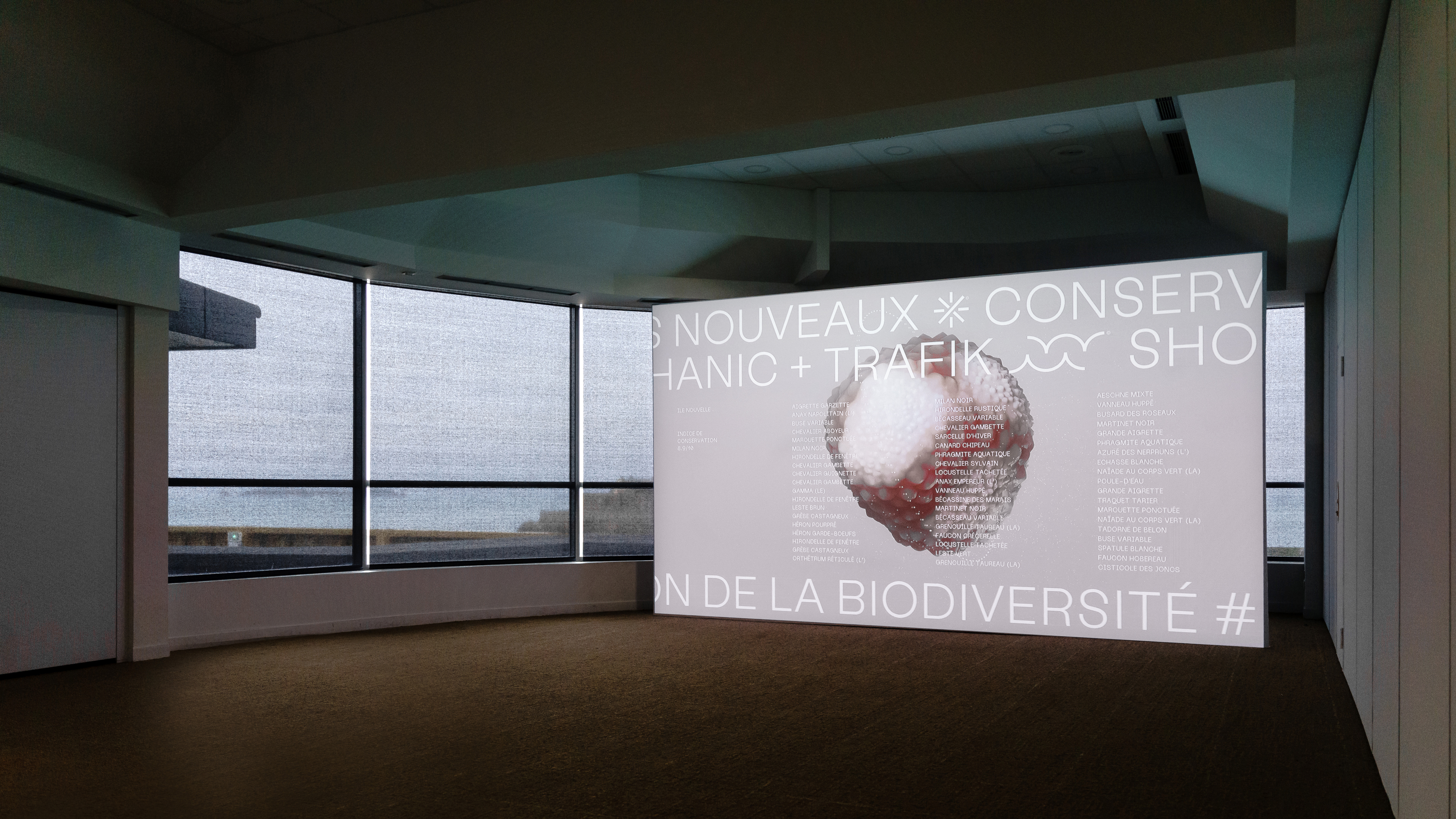
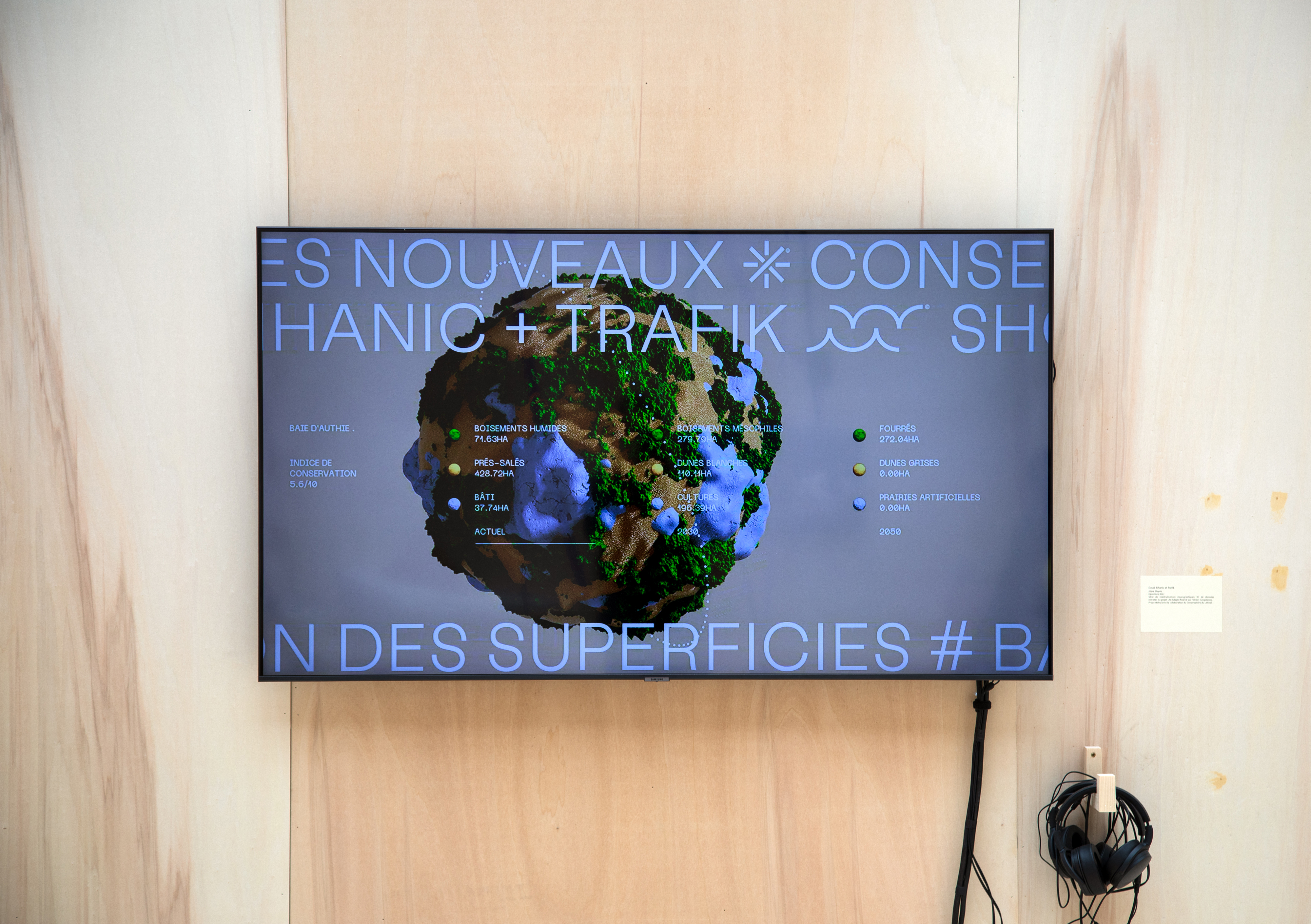
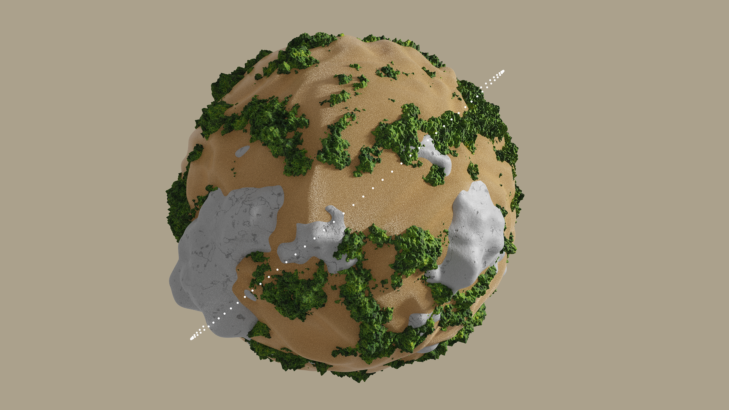
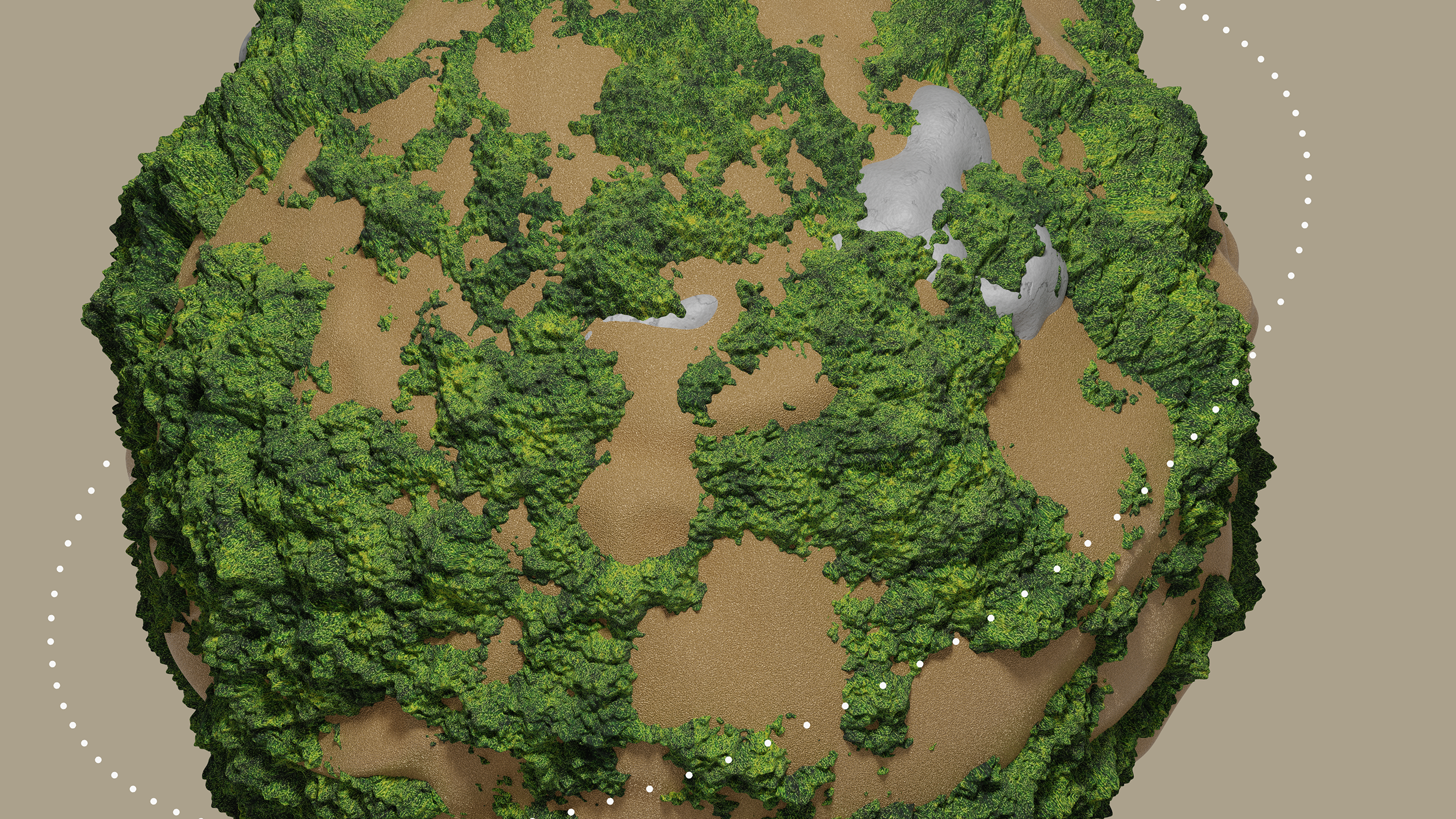
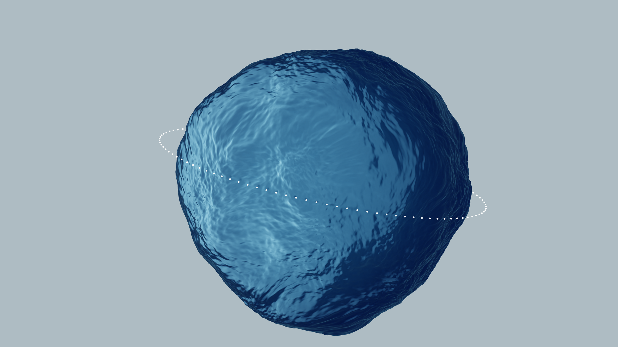
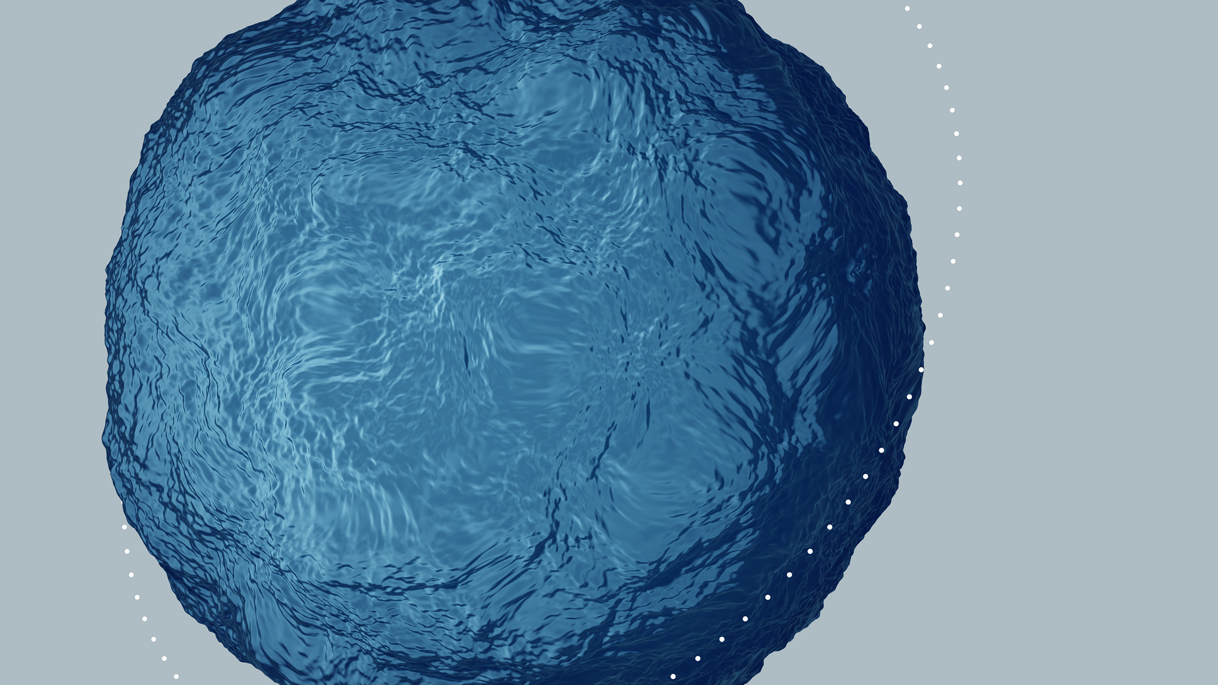
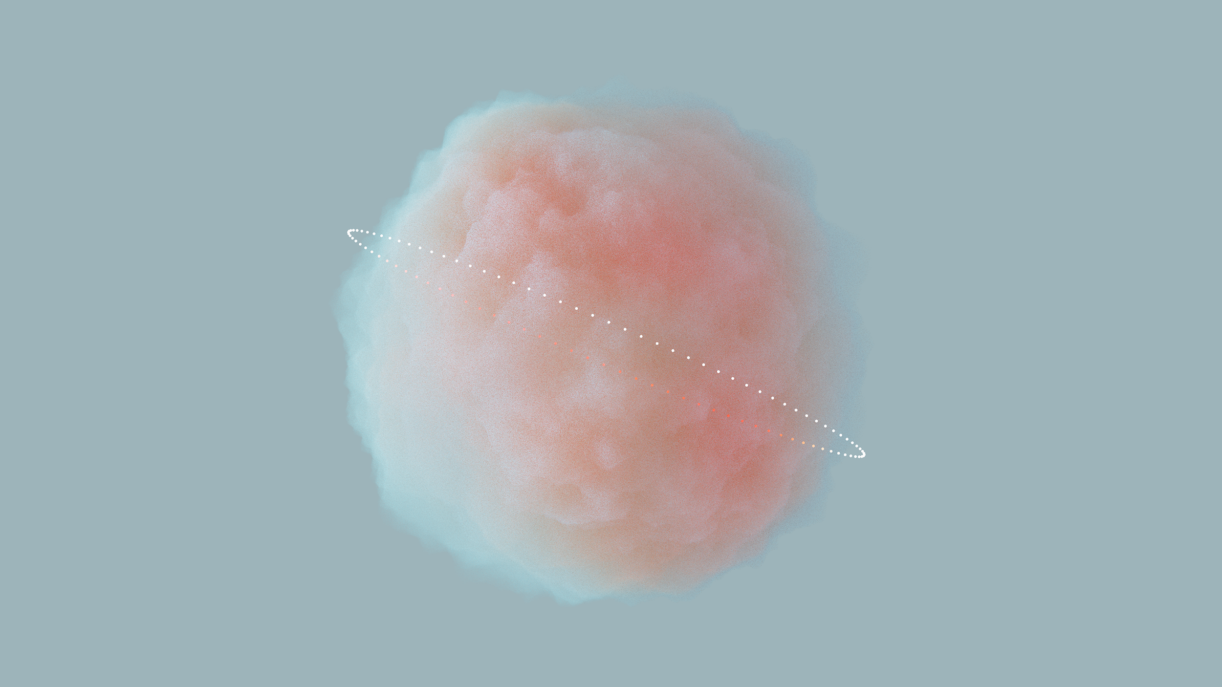
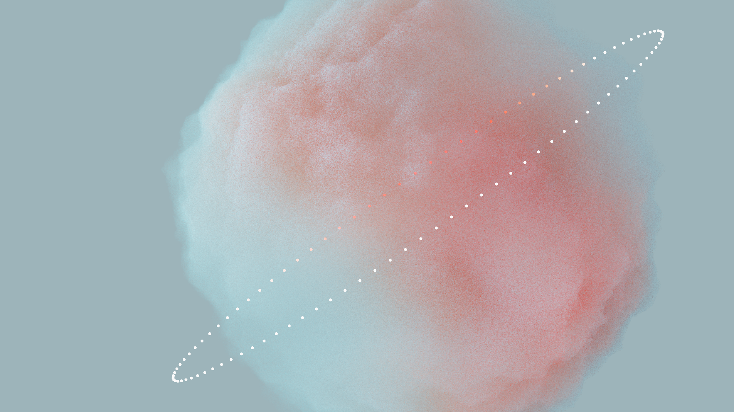
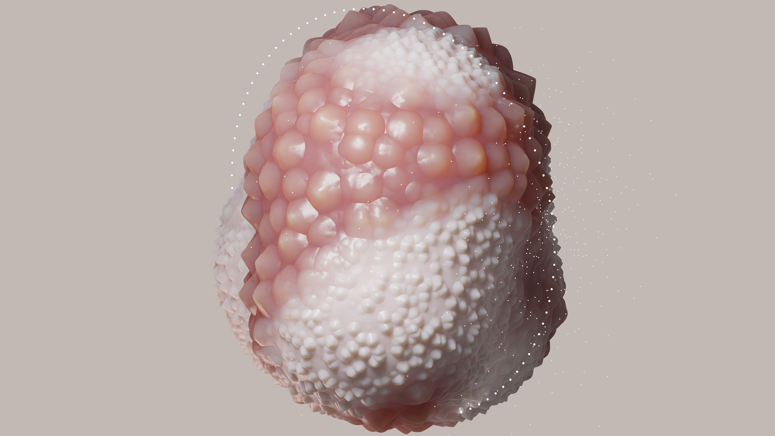
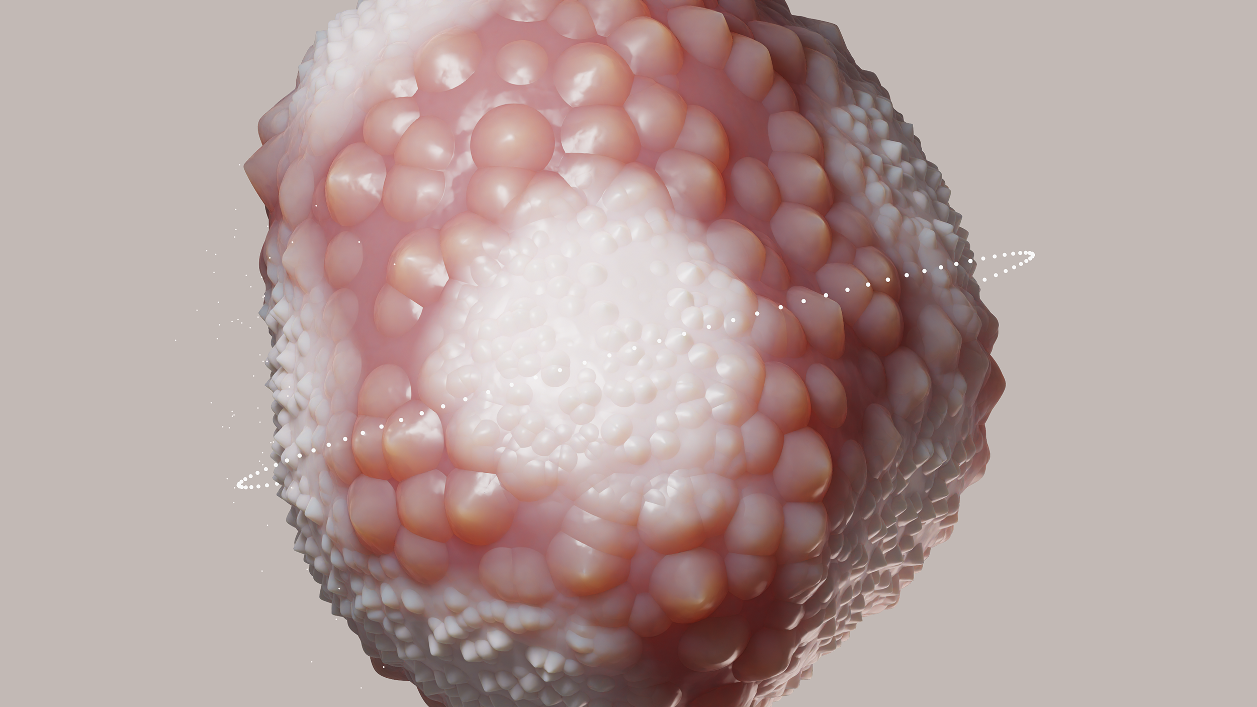
A winning project of the “Mondes Nouveaux” support program of the Ministry of Culture, Shore Shapes, designed-developed by David Bihanic, the Trafik agency and in collaboration with the French Conservatoire du Littoral, consists of a series of visual representations (or graphical materializations) of large datasets relating to the ten pilot natural sites of the Life–Adapto project financed by the European Union. Composed of four chapters/sections (1. Geology, 2. Submersion, 3. Perception, 4. Environment), this series of (3D) animated data shapes aims to make perceptible (i.e. both sensitive and intelligible) the different parts or “constituent strata” of natural sites, also their strictly dynamic properties (transformations, in particular, of shorelines over time) as well as their situation (or state) in a macro-ecological context. For each of the sites, a conservation index is graphically translated (via a ring encircling the 3D data shapes) reminding how much their evolutions (natural and anthropogenic) are, in some ways, dependent on the actions undertaken in favor of the protection of the coastal areas.
Comptant parmi les projets lauréats du programme « Mondes Nouveaux », Shore Shapes, conçu et réalisé par David Bihanic et l’agence Trafik avec la collaboration du Conservatoire du Littoral, consiste en une série de représentations/matérialisations visuo-graphiques de données relatives aux dix sites pilotes du projet Life–Adapto de l’UE. Composée de quatre tableaux ou chapitres (1. Géologie, 2. Submersion, 3. Perception, 4. Milieu), cette série de formes (3D) de données animées entend rendre perceptible (soit tout à la fois sensible et intelligible) les différentes « strates » constituantes des sites naturels, également leur caractère proprement dynamique (transformations, notamment, des lignes de rivage à travers le temps) ainsi que leur situation en contexte macro-écologique. Pour chacun des sites, il est traduit graphiquement (via un anneau ceinturant les formes 3D) un index de conservation rappelant combien leurs évolutions (naturelles et anthropiques) sont, dans une certaine mesure, dépendantes des actions engagées en faveur d’une protection des espaces littoraux.
—Ce texte fut rédigé pour l’exposition du projet dans le cadre du colloque de restitution du projet Adapto au Palais du Grand Large (Centre des Congrès) de Saint-Malo (du 30 novembre et au 1er décembre 2022).
Exhibition
This data artwork has been exhibited at the Beaux-Arts de Paris from April 11 to 16, 2023 within the “Mondes Nouveaux” program. The exhibition title was “Mondes Nouveaux X Beaux-Arts de Paris – An artistic rendezvous”.
It has been also exhibited within the framework of the Adapto project review colloquium held in the Palais du Grand Large in Saint-Malo (from November 30, to December 1st, 2022).
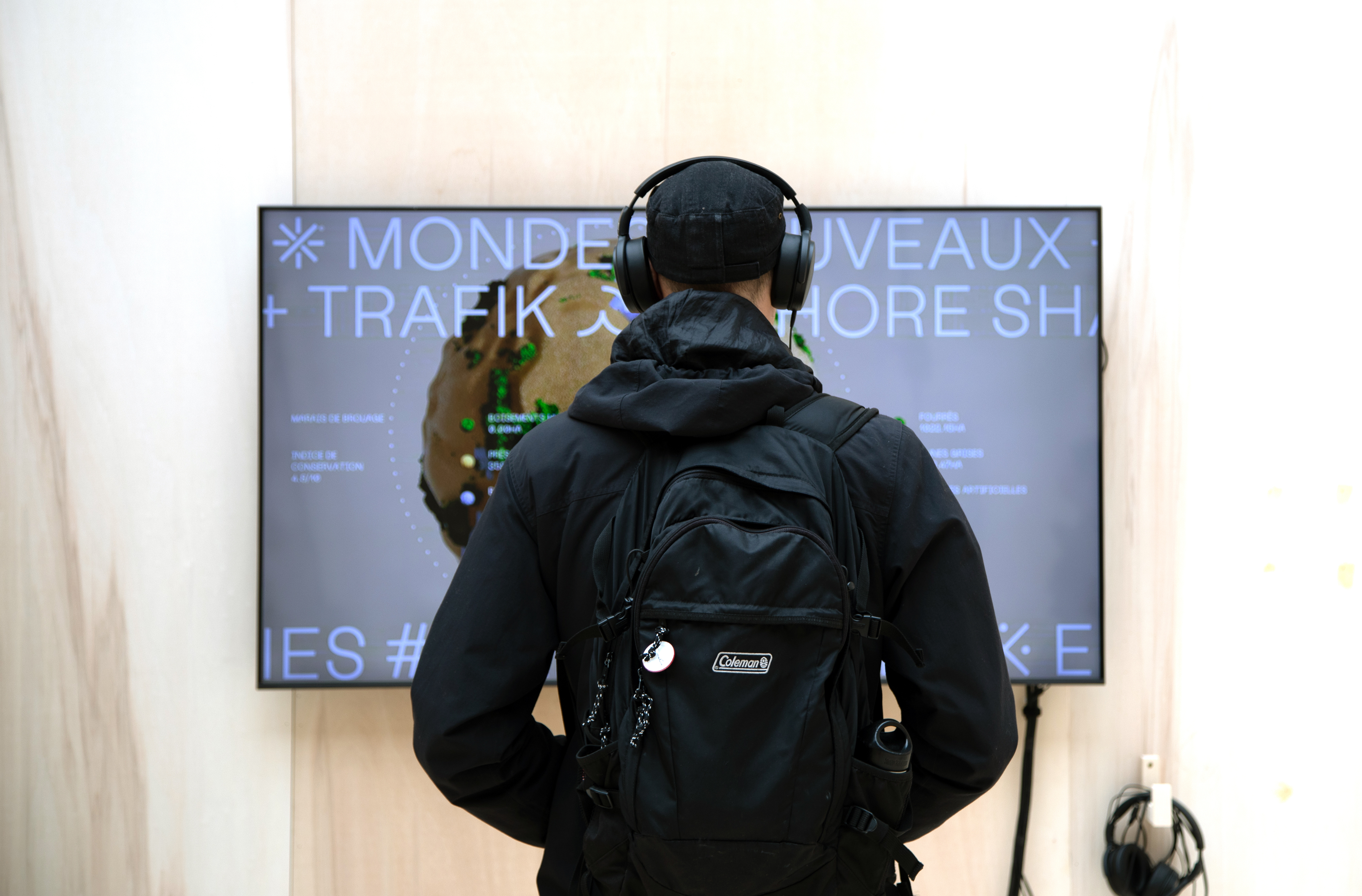
Images (St-Malo)
Images (Paris)
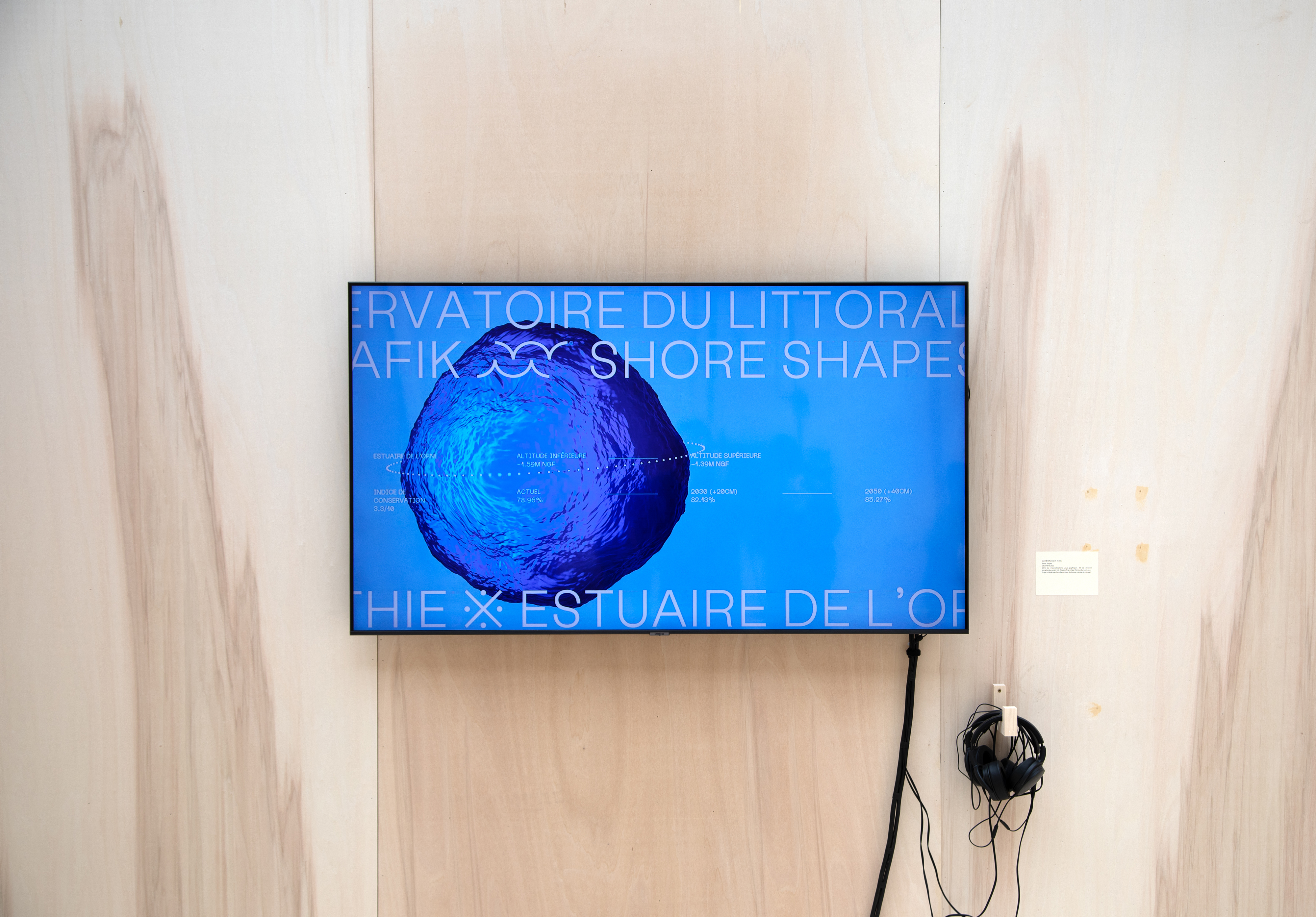
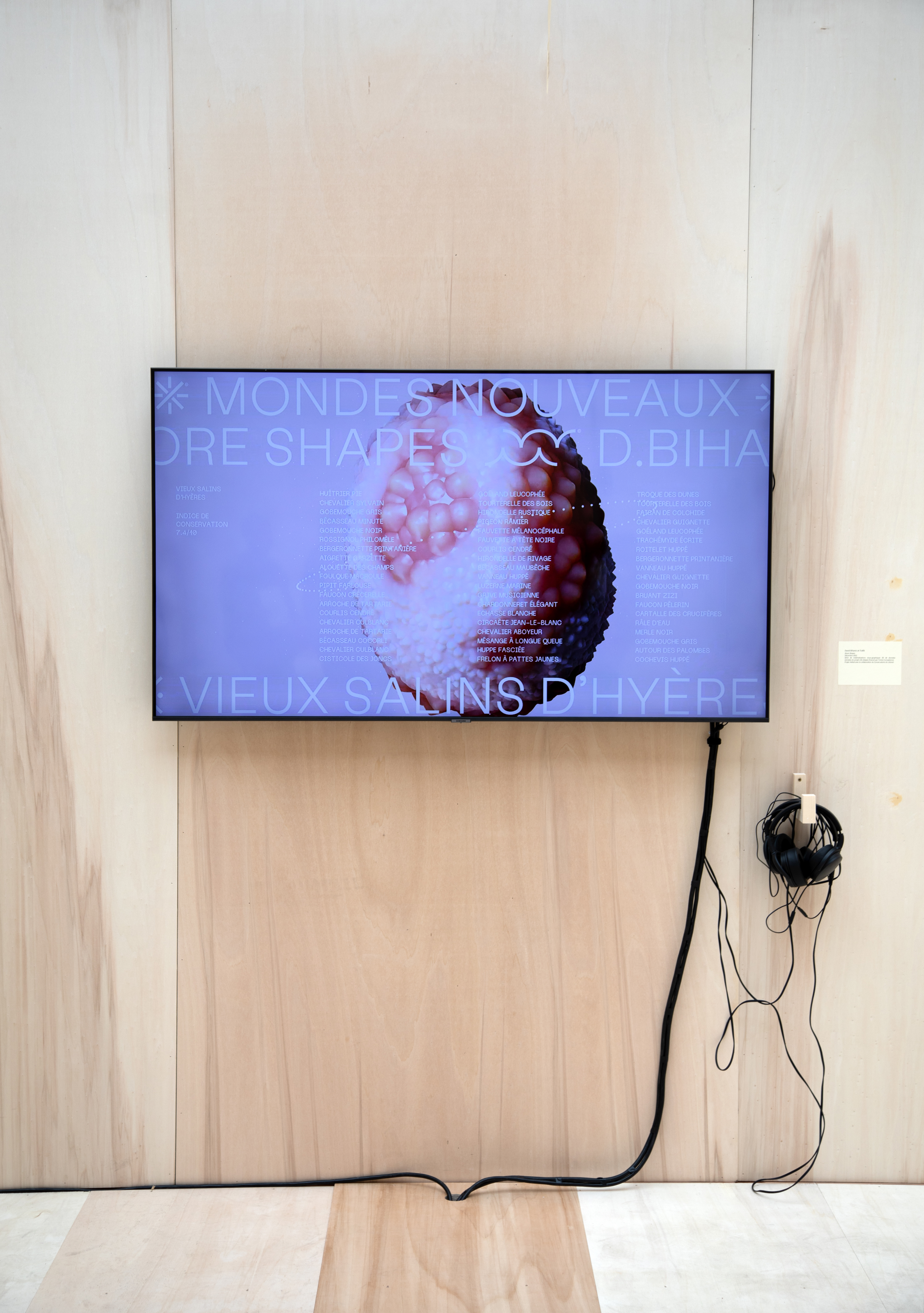
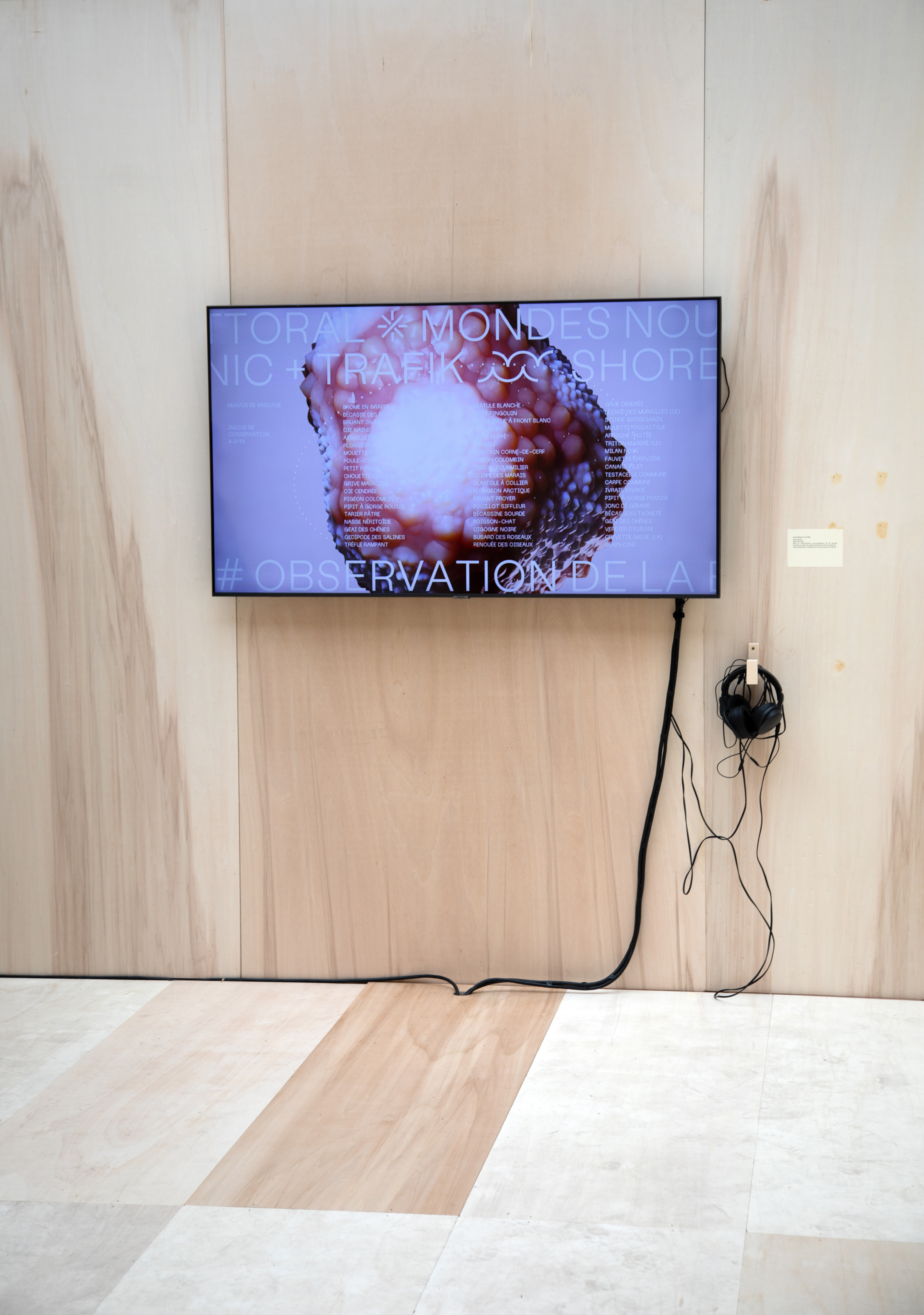
3D Data Shapes
Teasers
Data Sketches
The first phase of creative search consisted in designing/programming Data Sketches (graphical tests between 3D digital roughs and preparatory designs) — the main language used is JavaScript, through the Three.js library, for rendering in WebGL. Opening up to numerous iterations, these tests have for primary objective of allowing the definition of the formal bases of the project. Below are video preview of 3 data sketches steps.
000.2. 3D Data Sketches
004.15. 3D Data Sketches
0235. 3D Data Sketches
Team
This project was designed (data design) and developed (data analysis, 3D rendering and programming) with the collaboration of the creative studio Trafik, particularly Joël Rodière.
To mention: David Bihanic, Trafik, “Shore Shapes”, December 2022.
This project was funded by the French government as part of the national recovery and resilience plan.